The Meadows, nine sections west of Congress Avenue in ZIP 33436, is zoned for Tradewinds Middle, an A school in 2026, and Santaluces Community High, a B.
Last checked Oct. 8, 2026. Sources: the City of Boynton Beach’s neighborhood layer, Palm Beach County’s address points and municipal parks layer, the school district’s attendance boundaries, the Florida Department of Education’s 2026 school grades, Zillow Research, Palm Tran and OpenStreetMap.
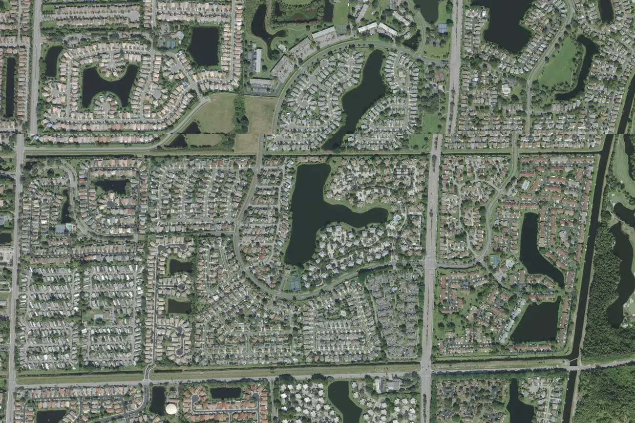
The Meadows is a neighborhood of single-family homes and townhouses in the north of the city, on the west side of Congress Avenue north of Miner Road. The city’s neighborhood map draws it as nine sections around a chain of lakes, each named “The Meadows” plus a section name, and lists one association, The Meadows 300 POA, for all of them. It is the only area in this guide zoned for Tradewinds Middle, which earned an A in 2026.
What this means for you
- Zoned high school: Santaluces Community High in Lantana for every address, a B school in Florida’s 2026 grades. Check yours with the district’s Find My School map.
- Home value: $410,837 in ZIP 33436 in August 2026, according to the Zillow Home Value Index.
- Nearest I-95 exit: exit 59, Gateway Boulevard, about 2.3 miles by road.
Part of our Boynton Beach neighborhoods guide.
Where it is
In the city’s neighborhood layer, the nine sections of The Meadows cover about 177 acres: Baytree, Clover Bend, Dogwood, Heather Lake, Meadow Lake, Misty Meadow, Wellesley, Willowbrook and Windemere, as the city spells them. Congress Avenue runs along the east side and Miner Road along the south side; Hypoluxo Road is about a third of a mile north and Lawrence Road about a third of a mile west. Boynton Lakes is across Congress Avenue to the east.
Palm Beach County’s address data has about 950 street addresses here, all in ZIP code 33436. About 540 are single-family homes and 410 are townhouses.
Schools
How the sections’ addresses fall in the school district’s attendance boundaries, with each school’s 2026 grade from the Florida Department of Education. The percentage is the share of possible points the school earned.
| Level | School | Share of addresses | 2026 grade |
|---|---|---|---|
| Elementary | Freedom Shores Elementary, 3400 Hypoluxo Road (report card) | 100% | C (51%) |
| Middle | Tradewinds Middle, 5090 S. Haverhill Road, Greenacres (report card) | 100% | A (65%) |
| High | Santaluces Community High, 6880 Lawrence Road, Lantana (report card) | 100% | B (64%) |
Tradewinds Middle moved up from a B in 2025 to an A in 2026. Boynton Lakes, across Congress Avenue, shares the same elementary and high schools but is zoned for Congress Community Middle instead. The elementary zones are the district’s 2026-27 boundaries; the middle and high zones are the layers the district labels 2025-26. Check the exact address with Find My School. More in our schools guide.
Home values
The typical home value in ZIP 33436 was $410,837 in August 2026, up 0.6% from $408,587 in August 2025, according to the Zillow Home Value Index. The index is a modeled typical value for the middle third of homes, single-family homes and condos together, not a sale price, and it covers the whole ZIP code, including large unincorporated areas, not just this neighborhood. The citywide Boynton Beach figure was $403,510, down 0.3% on the year. More in our home prices guide.
Parks and trails
From Palm Beach County’s municipal parks layer, with addresses from OpenStreetMap:
- Meadows Park, 4305 N. Congress Ave., on the neighborhood’s east side.
- Boynton Lakes Park, 300 Boynton Lakes Blvd., about a third of a mile east, where leashed dogs are welcome, according to the city’s dog-friendly parks page.
More in our parks and trails guide.
Getting around
- I-95: exit 59, Gateway Boulevard, about 2.3 miles by road from the middle of the neighborhood, or exit 60, Hypoluxo Road, about 2.4 miles.
- Downtown: about 4.5 miles to City Hall, 100 E. Ocean Ave.
- Airport: about 12.7 miles to Palm Beach International Airport.
- Tri-Rail: about 3.6 miles to the Boynton Beach station on High Ridge Road.
- These are distances measured on the OpenStreetMap road network with the OSRM routing engine, not drive times.
- Bus: Palm Tran Route 2 runs along Congress Avenue, according to Palm Tran’s route pages.
More in our getting around guide.
Property owners association
The city’s neighborhood layer lists The Meadows 300 POA for all nine sections. Association rules and fees are not public records we can check; ask for the governing documents before you buy.
Groceries and everyday stores
From OpenStreetMap:
- Publix with a pharmacy, North Congress Avenue at Hypoluxo Road, about four-tenths of a mile northeast
- Sprouts Farmers Market, North Congress Avenue, about seven-tenths of a mile southeast
How we drew this area
This page joins the nine The Meadows polygons in the City of Boynton Beach’s neighborhood layer. Addresses and school shares come from every Palm Beach County address point inside them, matched to the school district’s attendance boundaries on Oct. 8, 2026. Store and park locations are © OpenStreetMap contributors.
Frequently asked questions
What schools serve The Meadows in Boynton Beach?
Every address is zoned for Freedom Shores Elementary, Tradewinds Middle and Santaluces Community High in the school district’s boundaries. Tradewinds earned an A in Florida’s 2026 grades, Santaluces a B and Freedom Shores a C.
What ZIP code is The Meadows in Boynton Beach?
- Zillow put the typical home value in that ZIP code at $410,837 in August 2026, up 0.6% from a year earlier.
Is The Meadows in Boynton Beach a good place to live?
Here are the facts. The Meadows has about 950 street addresses, about 540 single-family homes and 410 townhouses, with Meadows Park on Congress Avenue. Its middle school, Tradewinds, earned an A in 2026, and I-95 exit 59 is about 2.3 miles away by road.
How far is The Meadows from I-95?
About 2.3 miles by road to exit 59, Gateway Boulevard, or 2.4 miles to exit 60, Hypoluxo Road, measured on the OpenStreetMap road network.
Have your say