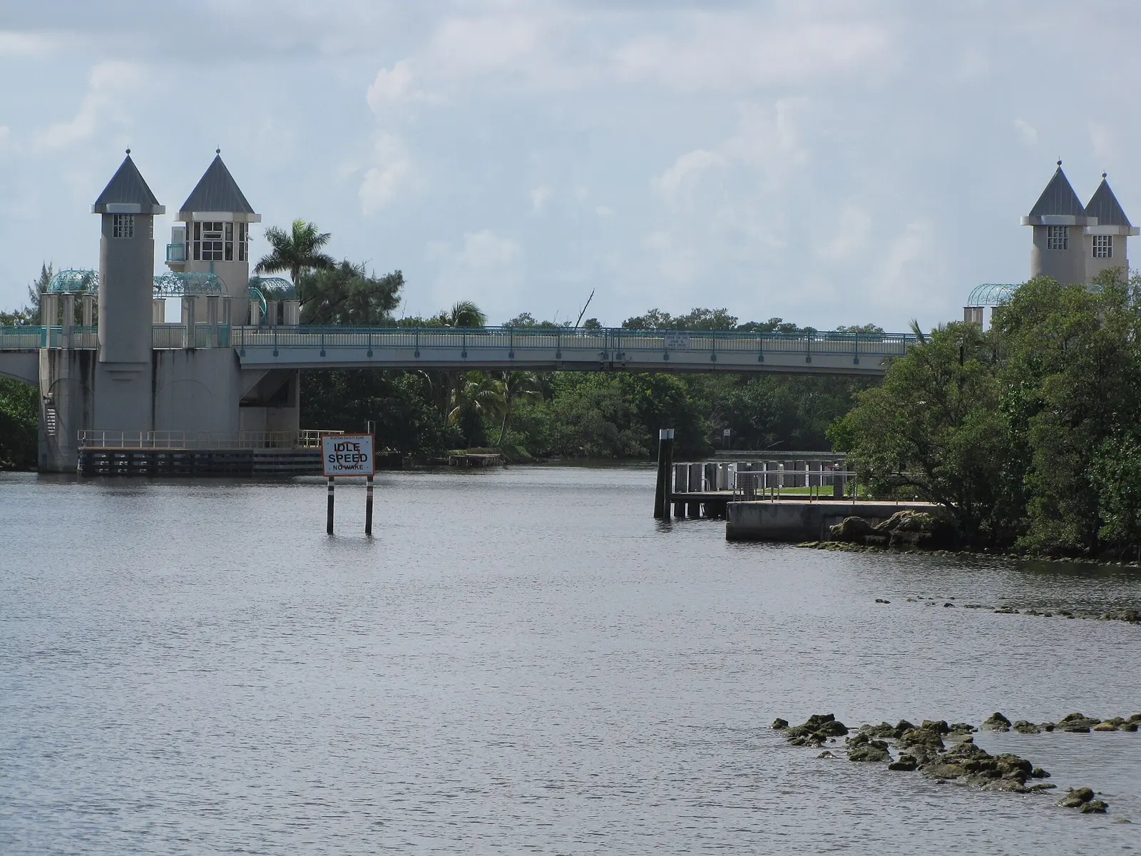
Downtown Boynton Beach, the CRA's 190-acre Downtown district in ZIP 33435, is mostly condominiums and is zoned for Boynton Beach Community High, a B school.
Last checked Oct. 8, 2026. Sources: the City of Boynton Beach’s CRA district layer and comprehensive plan, Palm Beach County’s address points, the school district’s attendance boundaries, the Florida Department of Education’s 2026 school grades, Zillow Research, the city’s Recreation & Parks pages, Palm Tran and OpenStreetMap.
Downtown Boynton Beach is the city’s civic and waterfront center, along Federal Highway and Ocean Avenue on the west side of the Intracoastal Waterway. City Hall and the city library both have the address 100 E. Ocean Ave., the Boynton Harbor Marina is on the water, and most of the homes are condominium units. For restaurants, events and parking, see our downtown visitor guide; this page is about living there.
What this means for you
- Zoned high school: Boynton Beach Community High for every address, a B school in Florida’s 2026 grades. Check yours with the district’s Find My School map.
- Home value: $308,335 in ZIP 33435 in August 2026, according to the Zillow Home Value Index.
- Nearest I-95 exit: exit 57, Boynton Beach Boulevard, about 1.5 miles by road.
Part of our Boynton Beach neighborhoods guide.
Where it is
This page uses the Downtown district of the city’s Community Redevelopment Area, one of seven districts in the city’s CRA layer. It covers about 190 acres along Federal Highway, from just south of Martin Luther King Jr. Boulevard almost to Woolbright Road, and from the Intracoastal Waterway west toward Seacrest Boulevard. Ocean Avenue and the east end of Boynton Beach Boulevard cross it. The Heart of Boynton district is to the northwest.
The city’s comprehensive plan also draws a Downtown TOD District, “a ½ mile radius around the intersection of Ocean Avenue and the Florida East Coast rail corridor,” planned around a future commuter rail station, and allows its highest densities near that crossing, according to the Future Land Use Element.
Palm Beach County’s address data has about 1,310 street addresses in the district, all in ZIP code 33435. About 920 are condominium units, 38 are marina condominium units, 45 are single-family homes and the rest are stores, offices and land.
Schools
How the district’s addresses fall in the school district’s attendance boundaries, with each school’s 2026 grade from the Florida Department of Education. The percentage is the share of possible points the school earned.
| Level | School | Share of addresses | 2026 grade |
|---|---|---|---|
| Elementary | Forest Park Elementary, 1201 SW Third St. (report card) | 52% | B (59%) |
| Elementary | Rolling Green Elementary, 550 Miner Road (report card) | 48% | B (55%) |
| Middle | Congress Community Middle, 101 S. Congress Ave. (report card) | 52% | C (51%) |
| Middle | Lantana Community Middle, 1225 W. Drew St., Lantana (report card) | 48% | B (59%) |
| High | Boynton Beach Community High, 4975 Park Ridge Blvd. (report card) | 100% | B (63%) |
Downtown is split roughly in half between two elementary and middle school zones, so two neighbors in the same district can go to different schools. The elementary zones are the district’s 2026-27 boundaries; the middle and high zones are the layers the district labels 2025-26. Check the exact address with Find My School. More in our schools guide.
Home values
The typical home value in ZIP 33435 was $308,335 in August 2026, up 1.7% from $303,174 in August 2025, according to the Zillow Home Value Index. The index is a modeled typical value for the middle third of homes, single-family homes and condos together, not a sale price, and it covers the whole ZIP code, not just downtown. The citywide Boynton Beach figure was $403,510, down 0.3% on the year. More in our home prices guide.
Parks and trails
Inside or at the edge of the district, from Palm Beach County’s municipal parks layer, the city and OpenStreetMap:
- Veterans Memorial Park, 411 N. Federal Highway, inside the district.
- Dewey Park, 100 NE Fourth St., where leashed dogs are welcome, according to the city’s dog-friendly parks page.
- Mangrove Park, with the Mangrove Dog Park at 799 E. Boynton Beach Blvd.
- Promenade Park, 700 E. Marina Way, on the water by the marina.
- Centennial Park and Amphitheater, 120 E. Ocean Ave., and the Children’s Park, 125 E. Ocean Ave., next to City Hall, according to the city’s facility pages.
- Boynton Harbor Marina, 735 Casa Loma Blvd., the base for fishing, dive and boat charters, according to the city’s marina page.
The city’s beach, Oceanfront Park at 6415 N. Ocean Blvd., is across the Intracoastal on the barrier island, in Ocean Ridge. More in our parks and trails guide.
Getting around
- I-95: exit 57, Boynton Beach Boulevard, about 1.5 miles by road from the middle of the district; exit 56, Woolbright Road, and exit 59, Gateway Boulevard, are each about 2.3 miles.
- City Hall: inside the district, at 100 E. Ocean Ave.
- Airport: about 14.4 miles to Palm Beach International Airport.
- Tri-Rail: about 5.4 miles to the Boynton Beach station on High Ridge Road.
- These are distances measured on the OpenStreetMap road network with the OSRM routing engine, not drive times.
- Bus: Palm Tran Route 1 runs along Federal Highway (U.S. 1), and Route 73 runs along Boynton Beach Boulevard to U.S. 1, then north to Gateway Boulevard, according to Palm Tran’s route pages.
More in our getting around guide.
Groceries and everyday stores
From OpenStreetMap:
- Walgreens, North Federal Highway, inside the district
- Publix, Southeast 18th Avenue at Federal Highway, about a third of a mile south
- Walgreens, South Federal Highway, about a quarter mile south
How we drew this area
This page uses the Downtown polygon in the City of Boynton Beach’s CRA district layer. Addresses and school shares come from every Palm Beach County address point inside it, matched to the school district’s attendance boundaries on Oct. 8, 2026. Store and park locations are © OpenStreetMap contributors.
Frequently asked questions
What school zone is downtown Boynton Beach in?
All of the CRA’s Downtown district is zoned for Boynton Beach Community High, a B school in Florida’s 2026 grades. About half of addresses are zoned for Forest Park Elementary and Congress Community Middle and half for Rolling Green Elementary and Lantana Community Middle.
What ZIP code is downtown Boynton Beach?
- Zillow put the typical home value in that ZIP code at $308,335 in August 2026, up 1.7% from a year earlier.
What kind of homes are in downtown Boynton Beach?
Mostly condominiums. Of about 1,310 street addresses in the CRA’s Downtown district in Palm Beach County’s data, about 920 are condominium units and 45 are single-family homes.
How far is downtown Boynton Beach from I-95?
About 1.5 miles by road to exit 57, Boynton Beach Boulevard, measured on the OpenStreetMap road network.
Have your say