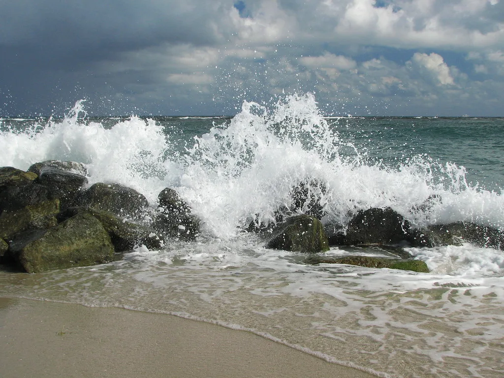
Dangerous rip currents through Saturday evening and minor high-tide flooding until noon Saturday, the weather service said. High tides 9:38 p.m. and 10:09 a.m.
Swimmers at Boynton Beach face dangerous rip currents through Saturday evening. Low-lying streets near the water could see some flooding at high tide through Saturday morning.
Updated Oct. 15: Both statements expired as scheduled Saturday, Oct. 10, without an extension. The weather service had no active alerts for coastal Palm Beach County on Thursday morning.
The National Weather Service in Miami issued both statements for coastal Palm Beach County at 1:45 a.m. Friday. The active alerts for the coastal Palm Beach County zone say:
- High rip current risk from 8 a.m. Friday through 8 p.m. Saturday. “Rip currents can sweep even the best swimmers away from shore into deeper water,” the weather service said.
- Coastal flood statement until noon Saturday, for “isolated minor coastal flooding.” The weather service expects “some water on low lying roads and property.”
Neither is a watch or a warning. No tropical watches or warnings are in effect for Palm Beach County.
When the water is highest
Flooding of this kind comes at high tide. These are the National Oceanic and Atmospheric Administration’s predicted high tides at its Boynton Beach station on the Intracoastal Waterway:
| Day | High tide | Height above mean lower low water |
|---|---|---|
| Friday | 9:38 p.m. | 3.3 feet |
| Saturday | 10:09 a.m. | 3.4 feet |
| Saturday | 10:18 p.m. | 3.2 feet |
Friday morning’s high tide came at 9:25 a.m. The coastal flood statement ends at noon Saturday, so the Saturday morning tide is the last one it covers.
What the tide gauges showed Friday morning
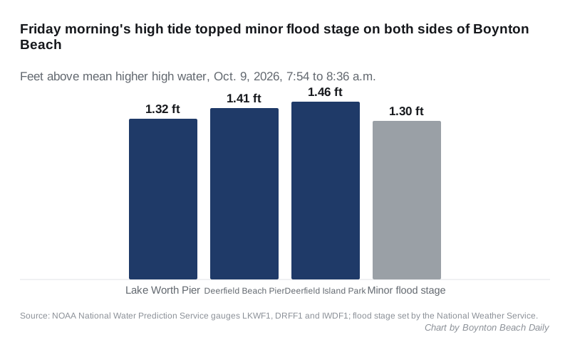
Ocean and Intracoastal gauges on both sides of Boynton Beach crossed the weather service’s minor flood stage on Friday morning. Minor flood stage is 1.3 feet above the average higher high tide at each of these gauges, according to NOAA’s National Water Prediction Service.
- Lake Worth Pier, about six miles north: 1.32 feet at 8:36 a.m.
- Deerfield Beach Pier, about 15 miles south: 1.41 feet at 7:54 a.m.
- Intracoastal Waterway at Deerfield Island Park, about 15 miles south: 1.46 feet at 7:54 a.m.
The Deerfield Beach Pier and Deerfield Island Park readings are on the weather service’s own gauge pages. Moderate flood stage at all three is 1.7 feet. No reading reached it.
Hurricane Isaias is in the Gulf
Hurricane Isaias is far from Boynton Beach. The National Hurricane Center’s 7 a.m. CDT intermediate advisory placed it about 245 miles south of Pensacola, Florida. It had winds near 110 mph and was moving north-northeast at 15 mph.
The hurricane center expects landfall Friday night or early Saturday. Its hurricane warning runs from Ocean Springs, Mississippi, to the Bay and Gulf county line in the Florida Panhandle. The weather service’s two statements for Palm Beach County do not mention the storm.
The local forecast calls for a chance of showers and thunderstorms Friday night and Saturday, with highs near 90 degrees. Showers and thunderstorms are likely Saturday night.
What it means for you
- At the beach, swim only where a lifeguard can see you. At the city’s Oceanfront Park, lifeguards are on duty from 9 a.m. to 5 p.m. every day. The beach conditions line is 561-742-6775.
- If a rip current catches you, the weather service said to relax and float, and not to swim against it. Swim parallel to the shoreline if you can. If you cannot escape, face the shore and call or wave for help.
- On the road, do not drive through flooded streets, the weather service said.
- Plan errands near the Intracoastal away from the high tides in the table above.
More on the beach and the parks is in our parks and trails guide. For storm season planning, see hurricane prep in Boynton Beach, and for outages, our power outages page.
Have your say